
Aerial Mapping
Welcome to our Aerial Mapping page, where innovation takes flight. At Sea Shadow Surveys Pty (Ltd), we harness the power of state-of-the-art drones and aerial platforms to provide you with accurate and comprehensive mapping solutions for both on-land and offshore planning.
Utilizing Advanced Technology:
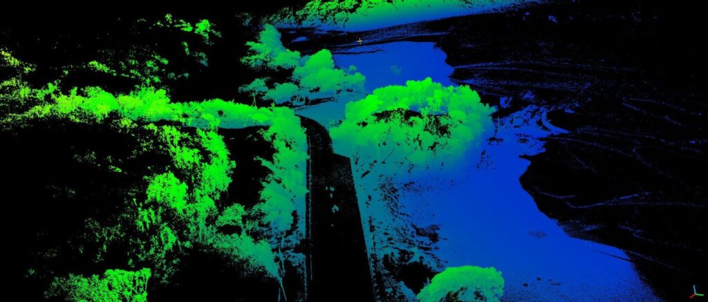
Our commitment to precision begins with our utilization of cutting-edge drones and aerial platforms. These advanced tools allow us to capture high-resolution photogrammetric and LiDAR data from various angles and elevations, creating a holistic view of your project area.
Detailed Photogrammetric and LiDAR Data:
We specialize in producing detailed photogrammetric and LiDAR data that captures the intricate details of your project site. From topographical features to infrastructure elements, our aerial mapping surveys provide the data you need to make informed decisions.
Creating Accurate Digital Terrain Models (DTMs):
One of our key capabilities is combining aerial data with bathymetric information to create accurate Digital Terrain Models (DTMs). These models provide a detailed representation of the land and underwater topography, offering insights that guide your project's direction.